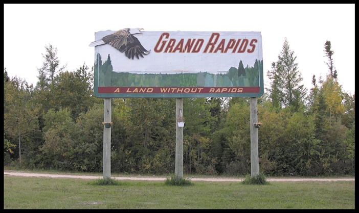
Following are some notes while researching 'Grand Rapids' Documentary.
Grand Rapids History (Notes from Martha Mcarthy book ~ 1988)
Local name for Grand Rapids was 'Meshea Pow-e-stick': Large
falls.
O nika pik: The carrying place. Oral tradition and memory.
1741 ~ La Verendrye established Fort Bourbon. (Near Lover's Point, or on Cedar Lake?)
1757 ~ Joseph Smith: Hudson Bay Company
1781 ~ Smallpox epidemic. Contact with a wide variety of foreign
people
~ exposure to diseases; measles, whooping cough, scarlet fever,
smallpox.
1814 ~ Freemen: discharged Voyagers ( 'Roi Du Lac' )
~ Former Northwest Company employees.
1821 ~ Hudson Bay Company and Northwest Company amalgamated.
1833 ~ Captain Back noted a farm belonging to a Freeman named
Turner
~ North shore of South River, west of Cedar Lake; barns, cows
and horses.
1850 - 1859 ~ Only two Cree lodges were noted on the North
bank,
a little below the rapids. Beardy, Cook. Peter Beardy was recognized
as
the Chief in 1875 Treaty.
1860 ~ S.H. Scudder from Harvard (United States) led an expedition
through Grand Rapids to study the solar eclipse from Cumberland
House.
1860s ~ Trading Posts established.
1870 ~ Hudson Bay Company negotiated settlement of title to
all land
within the Dominion of Canada.
1870s ~ Francois Mercredi, Dorion and Chartier families moved
to
Grand Rapids to work for HBC.
Treaty of 1875. Treaty was established because of potential
interest in
shipping, timber and minerals. Alexander Morris arrived on the
Colville
on September 26, 1875. At the time there were 115 members of
Grand Rapids Band. 160 acres per family of 5, and $5/ year payment.
1875 - 1903 Land was reserved by the government.
1877 ~ Duncan Sinclair surveyed the reserve, comprised in large
part
of muskeg. William Chief (formerly of St. Peter's Band) drew annuity.
1877 ~ Tramway was constructed between June and October at
a cost of
$21,109.30. 3.5 foot guage. 10 meters right of way on either side.
2,400 cross ties to the mile. Ballast filled the spaces between
the ties
to create level walkway for horses.
1878, 76 kgs Isinglas were produced.: translucent gelatin,
manufactured
from the air bladders of sturgeon, used for glue and paint.
1880s ~ Commercial Fisheries: Horse (Selkirk) Island.
1883 ~ 19 houses on the Reserve; people planted potatoes and
raised cattle.
People fished, were guides, and cut wood for the steamers in the
winter.
[$1/cord ~ 600 cords for Northwest Navigation in 1881/2.]
Put up ice in the winter.
1886 ~ Telephone line on the tramway.
1894 ~ Indian Agent, Joseph Reader, objected to the amount
of land received.
S. Bray sent to survey additional land, which was added in 1896.
1889 ~ Dominion Fish Company overfished the supply. The Bands
of Grand Rapids
and Norway House were concerned about the future of fish stocks.
1890s ~ Steamboats stopped running on the Saskatchewan River.
1893 ~ Commercial fishing increased. 140 men produced nearly
4 million pounds of fish. C.W. Gauthier formed Dominion Fish Company...
later Robinson Fishery... later taken over by American-controlled
Booth Fisheries.
No liscencing regulations until 1887. By 1900, 5 fishing companies
on
Horse Island employing 1,000 people. People remebered childhood
summers
in tents on Horse Island. Bottled boiled oil from whitefish intestines.
1898 ~ Former Hudson Bay clerk Henry McKay arrived in Grand Rapids.
1900 ~ Grand Rapids was part of the territory of Saskatchewan.
James Isbister
was the schoolteacher. M.S. Simpson was the Postmaster, then Henry
Mckay.
1902 ~ Sturgeon fishing was depleted in Grand Rapids. People
moved to
Cedar Lake and Cumberland.
1903 ~ Antoine Chartier had lived in Grand Rapids for 39 years.
John Chief, 30 years. John Dorien and Edward Cook occupied their
property for 20 years.
Lots from 2 to 10 acres were sold to Metis and other residents
for $1/Acre.
Other families; Ballantynes, Parenteaux, Sinclair, and Stove.
1909 ~ Hudson Bay Company closed their Post in Grand Rapids.
1912 ~ Henry McKay and Ovide Charlebois obtain the former HBC property.
1912 ~ E.B. Patterson studied water flow for potential power source.
1914-1915 W.E. Weld surveyed the possibilities of Grand Rapids for hydroelectric power.
[ Speculators imagined a manufacturing center at Grand Rapids
consisting
of a power dam, pulp mill, sawmill, and smelter. WW1 ended these
plans. ]
[Yet, another suggestion at the time was to lower water level
on Cedar Lake
to reclaim fertile delta farmland, by blasting rock at Demi Charge
(on the Saskatchewan River) and building a canal on Cedar Lake
to
increase water flow. By lowering water level by 5.8 meters, 4
million acres
of farmland would result.]
1915 Henry McKay became Police Magistrate.
1917 Steamship Wolverine arrived once a week. Dance hall, movie theatre, electricity.
1920 ~ James B. Campbell opened a store. After Campbell's death,
his wife Florence (daughter of Henry McKay) operated the store
and post office.
Her daughter Margaret Olafson continued the family tradition.
After WW2, engineering advances enabled construction of a larger dam.
The roar of the rapids under the ice shaking the ground.
North side of rapids was safer passage. Shorter portage.
Shoal rock called Upper Landing Place ~ the 'Big Stone' projected
out into the rapids.
Lake Winnipeg Research (Canadian Geographic Dec 2006):
10th largest freshwater lake in the world.
Drains 950,000 sq kilometers from BC to Ontario, and parts of
four US States.
(6.6 million people)
Every square meter of Lake Winnipeg represents 40 square miles
of drainage.
Saskatchewan River drains; Edmonton, Red Deer, Calgary, Moose
Jaw, Regina,
Saskatoon, Prince Albert, The Pas.
Red River/ Assinaboine; Brandon, Winnipeg, Kenora, Selkirk, Gimli.
Largest Walleye fishery in North America.
Gimli: $20 million in whitefish and pickerel
MV Namao (cree for 'sturgeon') $600,000/year to operate.
Lake Winnipeg Research Consortium
Federal Department of Fisheries and Oceans (DFO)
Eutophication: scientific term for overabundance of nutrients
in aquatic ecosystems.
Groundwater pollutants. Nitrogen from sewers, 20 million livestock,
and
24 million chickens and turkeys. Phosphorus from fertilizer and
dishwashers, etc... E-coli.
Hydro Dams limit flow.
When the artificial bloom of algae dies it sinks to the bottom
to decompose,
using up the lake's oxygen and creating dead zones.
Pollution in fish and debris in nets.
Blue green algae ~ neurotoxic cyanophytes.
Visible from space station.
---
Archeological Investigations in the Grand Rapids Reservoir
1961-62
William J. Mayer-Oakes, Department of Anthropology (Uof M)
Herbert Mckay: Boatman, guide, field-hand
Mr. Valentine McKay: Guide to Harbour Bay site (ancient river
mouth south of Reserve)